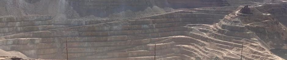
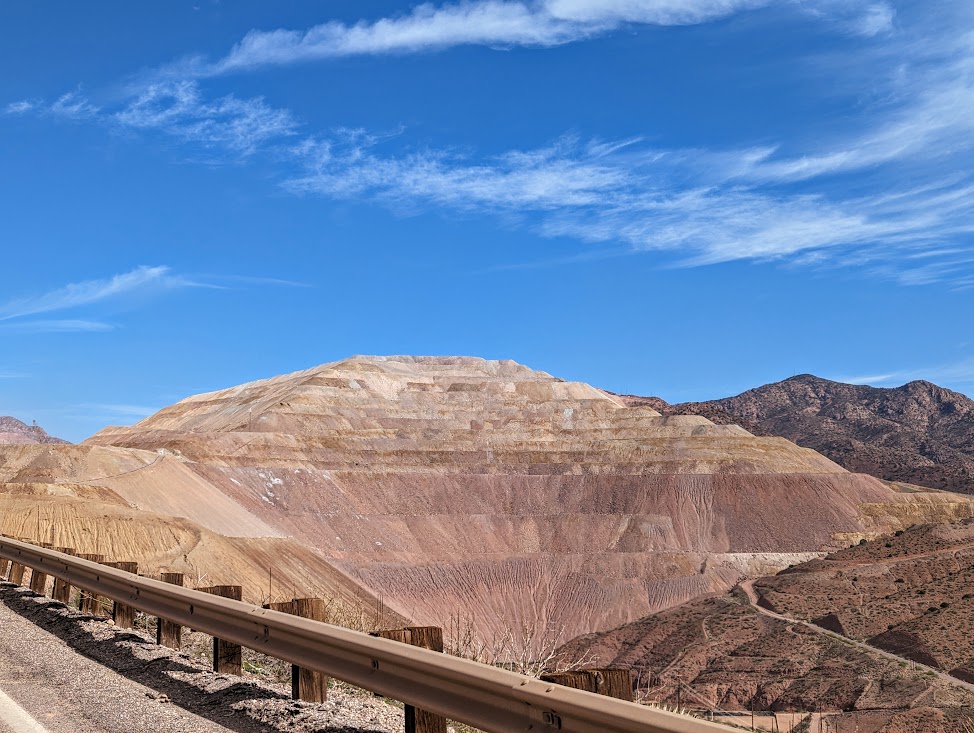
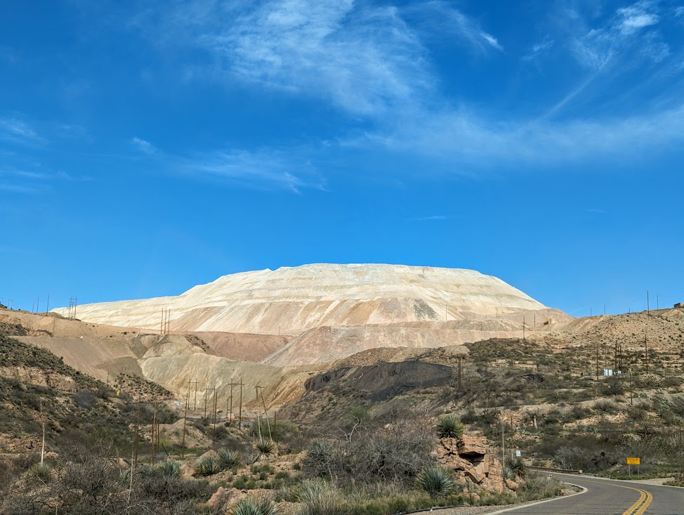
We had the opportunity over the past weekend to travel to and through parts of Southeast Arizona. While returning, we drove along U.S. 191 through the ginormous Morenci Copper Mine — the largest in the United States. This complex is simply mind-blowing for its size, scale, and scope!

First established as an underground mine in 1871, the Morenci Mine now occupies some 80 square miles (per viewpoint signage) or nearly four Manhattan Islands! Visitors can clearly see the mine when approaching the Clifton-Morenci area from many miles away. And driving through it on U.S. 191 takes approximately 10 miles, including passing under at least three tunnels or overpasses for the steady stream of Caterpillar 793 Mining Trucks carrying loads or returning for a refill (even a Sunday morning). By the way – Each truck can carry 240 tons per trip (per viewpoint signage).

You cannot help but be amazed (and impressed) by the continuous symmetry of the mining operation(s). At the same time, one can feel rather alarmed by our mechanized power over Mother Nature — in large part to fulfill our consumerist desires (or needs) for more electronic gadgets. However, reports indicate that available copper resources at the Morenci Mine will be exhausted by the mid-2040s.

What a future mine closure in two decades means for the 3,933 residents of Clifton and the 2,208 folks in Morenci is hard to fully comprehend. Many are employees of the mine or their dependents, not to mention the workers who commute from further afield in Greenlee County and surrounding areas. Certainly, there will be some employed for reclamation of this vast site. There is also a relatively new copper mine (since 2007) operating some 47 miles to the southwest of Morenci in Safford, Arizona

Across the American West are a plethora of mining towns that have faced boom and bust cycles before. Some have survived…many have not. How Clifton and Morenci will fare post closure remains to be seen. Completely retrofitting a local economy is a daunting task for any community. Doing it amid a noticeably altered landscape has to be more difficult.


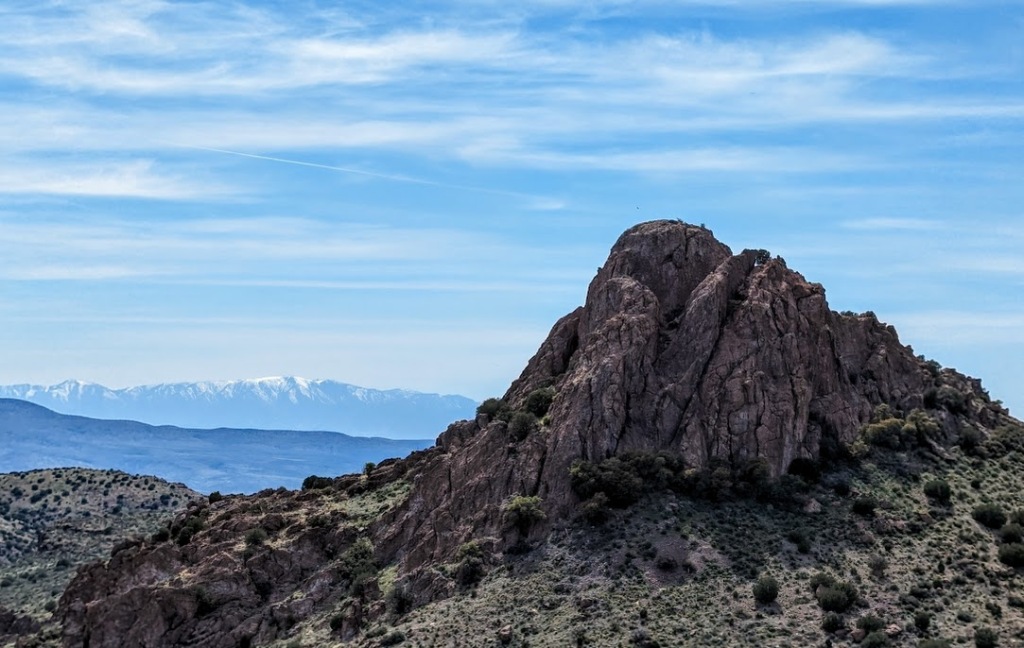
Hopefully, over time, these two towns will be able to navigate the upcoming changes successfully and find renewed purposes for themselves. Fortunately, they are situated in a lovely part of Arizona and along two of America’s most scenic roadway corridors — U.S. 191 (Coronado Trail) through the Apache-Sitegreaves National Forests and AZ 78 to the east of Clifton towards the Gila National Forest and the Mogollon Mountains in New Mexico.

Furthermore, there are a number of great examples of rediscovered and revitalized mining towns to provide Clifton and Morenci with guidance — wonderful places such as Bisbee, Arizona; Creede, Colorado; Leadville, Colorado; and Madrid, New Mexico to name just a few.
Peace!
SOURCES:
- Signage at the Morenci Mine viewpoint.
- mygooglemaps.com
- https://www.fcx.com/operations/north-america#morenci_link
- https://en.wikipedia.org/wiki/Morenci_mine
- https://www.mining-technology.com/projects/morenci/?cf-view
- https://www.mining-technology.com/marketdata/five-largest-copper-mines-the-us-2020/
- https://en.wikipedia.org/wiki/Clifton%2C_Arizona
- https://en.wikipedia.org/wiki/Morenci%2C_Arizona
- https://en.wikipedia.org/wiki/Safford%2C_Arizona
- https://greenlee.az.gov
- https://en.wikipedia.org/wiki/List_of_copper_mines_in_the_United_States
